

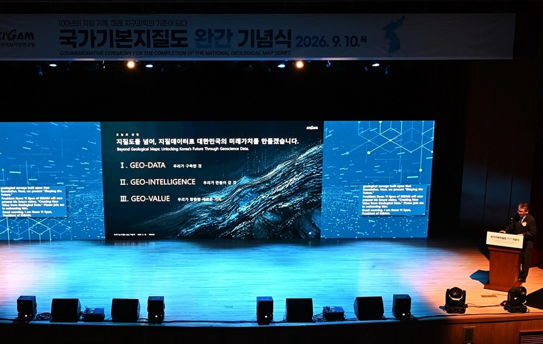
100여 년의 지질조사 끝에 한국 국토의 암석과 지층, 단층 등 땅속의 역사와 정보를 담은 ‘국가기본지질도’가 완성됐다.
After about a century of geological surveys, the National Basic Geological Map, a comprehensive record of the country’s history and geological features including rocks, strata and faults, has been completed.
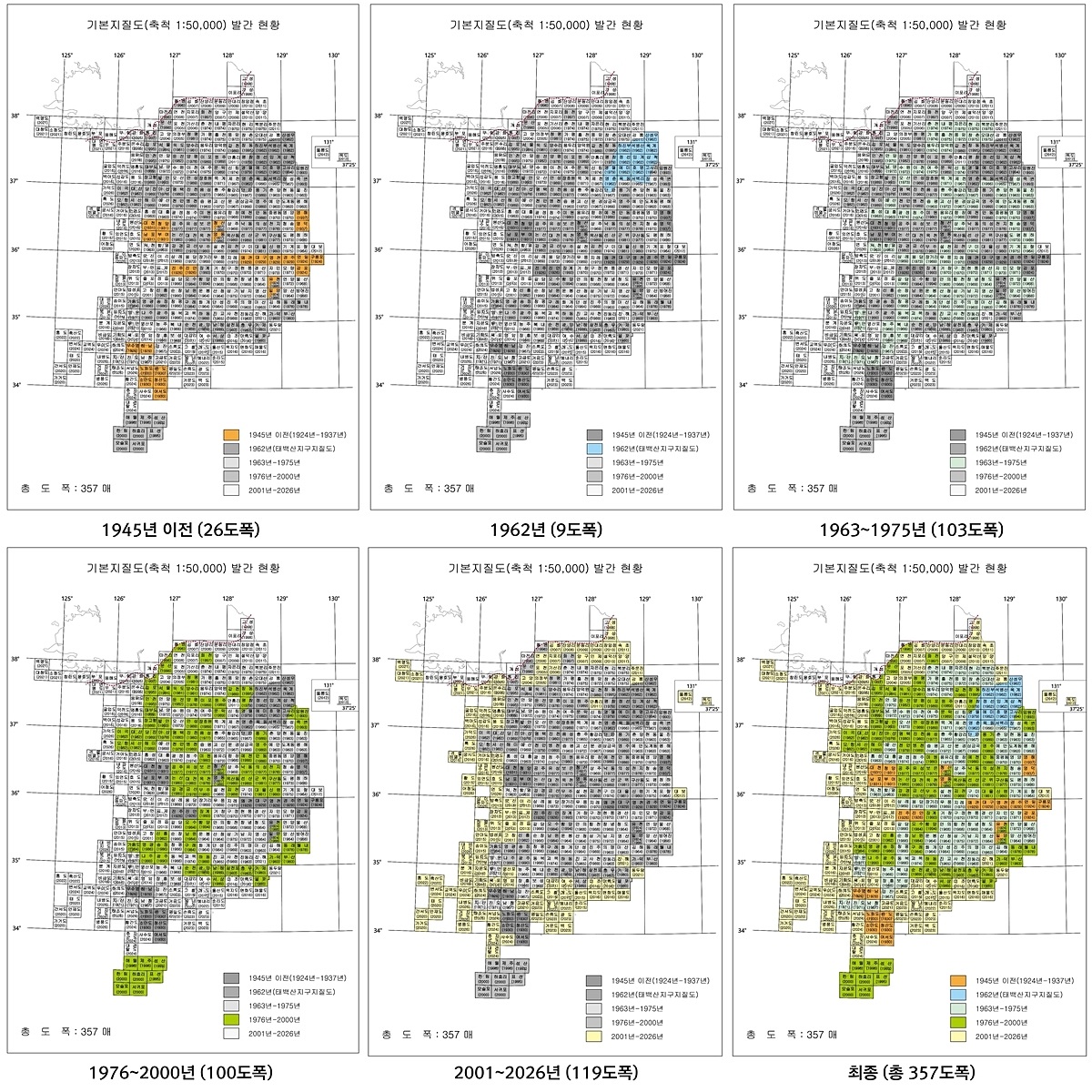
한국지질자원연구원(지질연)은 10일 대전 본원에서 1:50000 국가기본지질도 남한 지역 357도엽 완간을 공식 선포했다.
The Korea Institute of Geoscience and Mineral Resources (KIGAM) on Sept. 10 announced its completion of all 357 sheets of the map at its headquarters in Daejeon.
국가기본지질도는 한국 국토를 이루는 암석의 종류와 생성 시기, 지층의 분포와 선후관계, 단층·습곡 등 지질구조를 조사해 지도 위에 체계적으로 기록한 한국의 국가 표준 지질정보다.
The map is standard data on the country’s geological history, systematically documenting the types and formation periods of rocks comprising national landmass, distribution and sequence of geological strata, and geological structures such as faults and folds.
지상의 위치와 지형을 보여주는 일반 지도와 달리 국가기본지질도는 오늘의 국토가 어떤 과정을 거쳐 형성됐는지까지 담아낸다는 점에서 흔히 ‘땅의 역사책’에 비유된다. 국토의 형성 과정을 담은 한국의 ‘지질 역사서’이자, 국토를 이해하는 가장 기초적인 국가 자산으로 평가받는다.
Unlike general maps that show locations and topography, this map displays the processes through which Korea’s present-day territory was formed. Often dubbed a “history book of the land,” this basic national asset helps public understanding of the geological formation of the Korean Peninsula.
국가기본지질도는 광물자원 탐사와 사회기반시설 건설, 지하수·지하공간 활용, 지질재해 대응 등 다양한 분야에서 핵심 공공 인프라로 활용될 예정이다.
The map is expected to serve as crucial public guide for a range of applications including mineral resource exploration, construction of infrastructure, use of groundwater and underground spaces, and geological disaster response.
권이균 지질연 원장은 “국가기본지질도 완간은 100여 년간 국토를 직접 걷고 기록해 온 지질학자들의 헌신과 과학기술이 집약된 역사적 성과” 라며 “이 지질데이터를 인공지능·디지털 트윈과 융합해 국가 자원안보와 국민 안전을 뒷받침하는 새로운 가치를 만들어가겠다”고 말했다.
“The completion of the National Basic Geological Map is a historic milestone that embodies the dedication of geologists who have walked and documented national terrain for over 100 years, as well as advances in science and technology,” KIGAM President Kwon Yi Kyun said. “We will create new value by combining this geological data with artificial intelligence and digital twins to support national resource security and public safety.”
서애영 기자 xuaiy@korea.kr
By Xu Aiying, xuaiy@korea.kr
사진 = 한국지질자원연구원
Photo = Korea Institute of Geoscience and Mineral Resources

